 National Parks Journal

Photo: NPS/Rhodes Smartt · Public domain
Canyonlands National Park
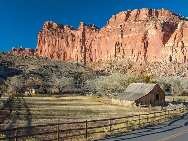
Canyonlands is a wilderness of canyons, buttes, and spires carved by the Colorado River and Green River. The park is divided into four distinct districts; no roads join them together. The districts share similar desert ecosystems, but each one provides unique opportunities for adventure and discovery.
Entrance Fees
Getting There
Roads and entrances can close temporarily. Check current conditions on nps.gov (opens in a new tab) before you go.
Entrances
- Directions to Island in the Sky Entrance Station (opens in a new tab)
Island in the Sky Entrance StationMain
Moab, UT · Open year-round, 24 hours
- Directions to Needles Entrance Station (opens in a new tab)
Needles Entrance Station
Monticello, UT · Open year-round, 24 hours
Separate district; no road connection to Island in the Sky (about 2 hours' drive)
- Directions to Hans Flat Ranger Station (The Maze) (opens in a new tab)
Hans Flat Ranger Station (The Maze)
Hanksville, UT · Open year-round; dirt roads may be impassable when wet
Remote Maze district; reached only by long unpaved roads, high clearance recommended
Airports
- CNY
Canyonlands Regional Airport · Moab, UT
ClosestSmall airportSmall regional airport. United Express flies to Denver year-round; Delta Connection flights to Salt Lake City are seasonal.
- SLC
Salt Lake City International Airport · Salt Lake City, UT
Major airport
Distances are approximate road distances; tap a distance for live driving directions.
Towns to stay in
Monticello, UTFor The Needles
No lodging inside the park · NPS lodging info (opens in a new tab)
Activities
Top Hikes
0.6 mi · 56 ft gain · loop
Short hike to an iconic cliff-edge arch framing canyon views and the La Sal Mountains. One of Utah's most popular sunrise photography spots.
Starts at: Mesa Arch Trailhead
1.8 mi · 73 ft gain · out & back
Spectacular panoramic views along the canyon edge of the White Rim Road and distant features in The Maze and The Needles.
Starts at: Grand View Point
8.1 mi · 1,516 ft gain · loop
The most challenging trail in Island in the Sky, encircling Upheaval Dome with steep switchbacks and boulder-field scrambling.
Starts at: Upheaval Dome Trailhead
1.2 mi · 114 ft gain · out & back
Short but steep trail to two overlooks of the mysterious Upheaval Dome — a unique circular geologic formation.
Starts at: Upheaval Dome Trailhead
Upcoming Events
Visitors are welcome to meet with a ranger at 9:00 am at the Horseshoe Canyon trailhead for a four-hour guided hike into Horseshoe Canyon. The hike includes stops at four major pictograph panels, including the Great Gallery, where the hike concludes. Visitors return to the trailhead on their own. The hike is considered strenuous, with a 780' descent and ascent, long stretches of walking in loose sand, and limited shade. Please bring four liters/quarts of water per person, snacks/lunch, appropriate shoes for hiking over rough terrain in the desert, and sunscreen/sun-protective clothing. More info: The hike to the Great Gallery is seven miles (11.2 km) roundtrip, requiring five hours or more. A steep descent of 780 feet (237 m) at the beginning means a steep climb back up at the end of the hike. Pets are prohibited on the trail or below the rim of Horseshoe Canyon. Group size is limited to 20 people. Larger groups must arrange in advance to go with a ranger or split into smaller groups. Bring your own drinking water. We recommend one gallon (4 L) per person. There is no water at the trailhead, and water sources are unreliable within the canyon. A map of the trailhead location can be found at: Horseshoe Canyon (nps.gov) Please call the Hans Flat Ranger Station (435-241-3105) for further information or current road conditions.
Best Time to Visit Canyonlands
Best time to visit: April–May, September–October
The best time to visit Canyonlands National Park is April–May and September–October. Spring and fall have highs of 60–80°F; summer highs reach the 90s and can exceed 100°F, with monsoon flash floods.
In those months, average highs are 62–80°F at Island in the Sky Visitor Center. May is the busiest month on average.
Monthly averages at Island in the Sky Visitor Center (5,880 ft). Climate normals (1991–2020): PRISM Group, Oregon State University.
Weather & Climate
Canyonlands is part of the Colorado Plateau, a "high desert" region that experiences wide temperature fluctuations, sometimes over 40 degrees in a single day. The temperate (and most popular) seasons are spring (April-May) and fall (mid-September-October), when daytime highs average 60 to 80 F and lows average 30 to 50 F. Summer temperatures often exceed 100 F, making strenuous exercise difficult. Winters are cold, with highs averaging 30 to 50 F, and lows averaging 0 to 20 F.