 National Parks Journal

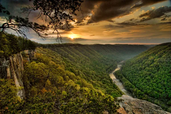
Photo: Gary Millar · CC BY 2.0
Great Smoky Mountains National Park
Ridge upon ridge of forest straddles the border between North Carolina and Tennessee in Great Smoky Mountains National Park. World renowned for its diversity of plant and animal life, the beauty of its ancient mountains, and the quality of its remnants of Southern Appalachian mountain culture, this is America's most visited national park. Plan your visit today!
Entrance Fees
No entrance fee. Other fees may apply for tours, camping, or transportation.
Getting There
Roads and entrances can close temporarily. Check current conditions on nps.gov (opens in a new tab) before you go.
Entrances
- Directions to Gatlinburg Entrance (Sugarlands Visitor Center) (opens in a new tab)
Gatlinburg Entrance (Sugarlands Visitor Center)Main
Gatlinburg, TN · Open year-round (Newfound Gap Road can close for snow)
- Directions to Cherokee Entrance (Oconaluftee Visitor Center) (opens in a new tab)
Cherokee Entrance (Oconaluftee Visitor Center)Main
Cherokee, NC · Open year-round (Newfound Gap Road can close for snow)
- Directions to Townsend Entrance (opens in a new tab)
Townsend EntranceMain
Townsend, TN · Open year-round
- Directions to Cosby Entrance (opens in a new tab)
Cosby Entrance
Cosby, TN · Cosby area road open year-round; campground seasonal
- Directions to Cataloochee Valley (opens in a new tab)
Cataloochee Valley
Waynesville, NC · Usually open year-round; can close in winter weather
Remote valley on a narrow gravel road; no road link to the rest of the park
Airports
- TYS
McGhee Tyson Airport · Alcoa, TN
ClosestMajor airport
Distances are approximate road distances; tap a distance for live driving directions.
Towns to stay in
Maggie Valley, NCFor Cataloochee
Activities
Top Hikes
2.6 mi · 400 ft gain · out & back
Paved trail through mixed hardwood forest to an 80-foot waterfall, one of the most popular hikes in the park.
Starts at: Laurel Falls Trailhead
4.6 mi · 1,200 ft gain · out & back
Through old-growth forest and Arch Rock formation to the massive Alum Cave Bluffs overhang. Can extend to Mt. LeConte.
Starts at: Alum Cave Bluffs Trailhead
5.6 mi · 1,500 ft gain · out & back
Steep trail through diverse forest to a waterfall named for the misty rainbow that often appears on sunny afternoons.
Starts at: Rainbow Falls Trailhead
5 mi · 700 ft gain · out & back
Winds through rhododendron and hemlock forest in Cades Cove to a powerful 25-foot waterfall.
Starts at: Abrams Falls Trailhead
Upcoming Events
Down on the Farm
Immerse yourself in Smokies history! Engage with park rangers and living historians to find out how families survived - and thrived - here through daily chores such as blacksmithing, fence making, and hearth cooking. Program topic varies.
Kuwohi Unveiled: Wild Wonders & Culture Await
Discover Kuwohi's ranger program - where engaging talks unveil the wonders of local wildlife, ecology, and cultural heritage. Gain unique insights into the area's natural and historical richness, and deepen your appreciation for Kuwohi.
Junior Ranger Ramble at Sugarlands
Join a ranger for a walk, talk, or guided activity to learn more about natural and cultural history and become a steward of the park. Topics vary daily. Check Sugarlands Visitor Center for more information.
Best Time to Visit Great Smoky Mountains
Best time to visit: April–May, September–October
The best time to visit Great Smoky Mountains National Park is April–May and September–October. Spring wildflowers and fall color come with comfortable hiking temperatures; summer brings heat, haze, and afternoon thunderstorms.
In those months, average highs are 70–80°F at Sugarlands Visitor Center. October is the busiest month on average, while April is noticeably quieter.
Monthly averages at Sugarlands Visitor Center (1,470 ft). Climate normals (1991–2020): PRISM Group, Oregon State University.
Weather & Climate
Elevations in the park range from approximately 875 feet (267 meters) to 6,643 feet (2,025 meters) and the topography can drastically affect local weather. Temperatures can vary by 10-20 degrees Fahrenheit from mountain base to top, and clear skies lower down do not guarantee equally pleasant weather at higher elevations.